$bp(“Brid_89337291”, “id”:”21403″,”width”:”16″,”height”:”9″,”video”:”1355629″);
Happy Friday to you!
It’s going to be another scorching hot day for SWFL today — but there will be more storms out there this afternoon and evening that will help to cool us down a bit.
We’ll start with a quiet morning. Under mostly sunny skies look for temperatures to climb quickly from our morning lows in the upper 70s to afternoon highs in the middle 90s. Factoring in the high humidity, heat index values will range from 105° – 110° this afternoon. As such a *Heat Advisory* is in effect for Collier, Glades and Hendry this afternoon. Stay hydrated and take breaks from the heat when you can this afternoon if you have to be outdoors.
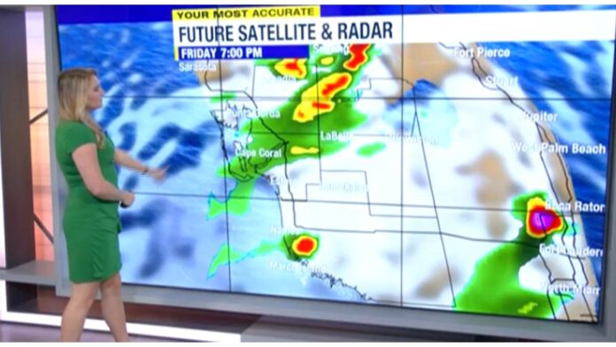
While the morning will be dry, storms will begin to develop around lunchtime, wotward the coast, becoming widespread as we head into the later afternoon/early evening. The best rain chances will be along and east of I-75, though a few storms will try to work toward the coast late as well. While severe storms aren’t expected a few could be strong, packing heavy rain, frequent lightning, and in a few cases gusty winds.
Storms will be more scattered to isolated in coverage for the weekend. The heat will stick around as well, with highs holding in the middle and lower 90s.
Tracking the tropics:
The only area of concern in the Atlantic right now is an area of low pressure in the central Atlantic that has a high chance to develop into a tropical depression or tropical storm later today. If it took a name, it would Don. Regardless, it will remain over the open Atlantic and is no threat to land.
The post Forecast: a hot and rainy end to the week appeared first on ABC7 Southwest Florida.


