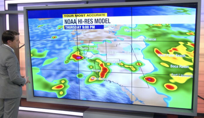
A couple additional storms will move through Southwest Florida Thursday evening. Most of the rain will come to an end by the time it gets dark. Areas that do see rain should expect overnight lows below 80. Meanwhile, people who miss out on the evening rain will be a few degrees warmer.
Friday starts out partly to mostly cloudy, with a chance of rain in the urban corridor. After lunchtime, the roles reverse with sunshine near the coast and storms inland. The evening looks to be drier across SWFL, but an isolated shower or t-storm is still possible. Highs are in the lower 90s.
We are expecting a pretty soggy weekend with a round or two of rain each day.
Tracking the Tropics:
Part of the reason for the stormy pattern is because of a broad area of low pressure trying to form in the Gulf. If the disturbance were to form into a tropical depression (not very likely), SWFL would not be directly impacted. The area of concern is actually expected to drift away from us over the weekend, before it even starts to gain tropical characteristics.
There are two other areas in the tropical Atlantic that have a medium chance for development in the next week. Both disturbances are moving west-northwest across the central tropical Atlantic. Neither looks to be a threat to Florida at this point, but we’ll be monitoring them closely regardless.


